
Implementation Strategies
Access Management
Frontage Road Requirements
Land Use Regulations
Roadway Design Manuals & Guidelines
Multimodal Street Classification Systems
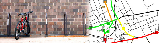
Pedestrian, Bicycle Facilities and Trails
(Multimodal Transportation Infrastructure)
What are design standards and policies?
Land development regulations and design guidelines have been used successfully in many cities to encourage private developers to develop denser growth, which in turn promotes the extension of local street networks and the viability of multimodal transportation. Design standards and policies can be used to regulate specific physical elements of urban form and roadway design, such as the size, scale, and orientation of buildings, streetscape requirements, or the provision of sidewalks and bus shelters.
Traditional roadway design standards and policies consist of guidelines for highway and transportation engineers for provisions for autos and trucks (lane width, turning lane length, pavement materials, access points, etc). Newer ways of thinking about roadway design incorporate the needs of all roadway users, including pedestrians (sidewalks, lighting, crosswalks), bicyclists (bike lanes, signage) and transit riders (bus stops, shelters).
Why and where are they applied?
Design standards and policies are applicable to many types of transportation and land use plans and projects. Roadway design standards are usually established and enforced by the agency responsible for the approval, construction, and maintenance of the roadway network. Municipal roadway design standards are often based upon state and national guidelines, with some variations to account for local plans and policies. Consistency between national, state and local standards is important, particularly where a difference may affect traveler safety, traffic control and operation. Two key resources upon which many agencies rely are AASHTO's The Policy on Geometric Design of Highways and Streets (informally known as the "Green Book") and The Manual on Uniform Traffic Control Devices (MUTCD).
Flexibility in design standards and policies is important to consider, however, in order to address variations in local contexts. Many design elements for pedestrian, bicyclist and transit, and localized auto travel are best addressed through a local scope. Because these elements affect the character of a community, they should be designed with local principles and priorities in mind. This line of thinking is the essence of context sensitive solutions, which is not just a design approach but an innovative way to approach the entire roadway design process. In addition, locally adopted land use design standards are an important element of context sensitive solutions, since they regulate the built environment surrounding the corridor.
Context sensitive solutions are most prominent in urban and suburban areas with a diverse street network, but rural areas benefit from context sensitive solutions as well, particularly as an approach to preserving scenic corridors and designing gateways to village centers along major highways. The concept of complete streets is applicable for all road contexts, and is especially important in communities where the population is aging and residents will need alternatives to single-occupant vehicle travel.
Where can I get more information?
- MDT's Road Design and Traffic Engineering Manuals
- MDT's Context Sensitive Solutions Resource Page
- AASHTO Green Book: A Policy on Geometric Design of Highways and Streets
- Urban Street Geometric Design Handbook
- FHWA The Manual on Uniform Traffic Control Devices (MUTCD)
- 23CFR625 is a useful reference for federal-aid projects and projects on the NHS (regardless of project funding). This section of the federal regulations describes those standards' documents and guides that FHWA adopts.
- The Context Sensitive Solutions web site, sponsored by the Federal Highway Administration, provides resources for planners, engineers and policy makers on collaborative, interdisciplinary approaches that involve all stakeholders in providing transportation facilities that fit their settings. Context Sensitive Solutions (CSS) focuses on preserving and enhancing scenic, aesthetic, historic, community, and environmental resources, while improving or maintaining safety, mobility, and infrastructure conditions.
- A useful CSS guidebook entitled "Context Sensitive Solutions in Designing Major Urban Thoroughfares," was developed in 2006 through a joint effort among the Congress For New Urbanism, the Institute for Transportation Engineers, the Federal Highway Administration and the US Environmental Protection Agency. A fact sheet is available at https://www.epa.gov/sites/default/files/2015-11/documents/rp036.pdf
- Many communities are adopting overarching Complete Streets policies to guide transportation planning and roadway design initiatives. These policies are not, in and of themselves, design standards and policies, but they can serve as an important foundation for more collaborative, multimodal transportation planning. The National Complete Streets Coalition web site provides resources for advocates, citizens, engineers, decision-makers and more about this national initiative to make streets accessible to all users.
- The Smart Growth Leadership Institute has an online toolkit providing basic information and practical land use and transportation planning tools to help communities grow smartly and sustainably, including policy, code and zoning audits and strategy builders.