
What are scenario planning analysis tools?
A variety of scenario planning software tools have been developed to assess the relationship between transportation, land use, and economic development. The FHWA Tool Kit for Integrating Land Use and Transportation Decision-Making provides an overview and case studies of several of these software platforms.
Some of the most commonly used scenario planning tools include GIS computer simulations to develop alternative future land use scenarios and models to assess factors such as land consumption, travel demand, water and sewer demands, and public expenditures. Each tool is designed to address a specific set of questions, using a specific set of assumptions and hence, tools vary in context for application, budget, and technical capabilities. Two scenario planning tools that have been applied in Montana are CommunityViz and Spatial Growth Model. A brief description of these tools, as well as others that have been used across the US, are provided below:
- CommunityViz is a tailored GIS software package that allows users to create and manipulate a virtual representation of a town and explore different land use scenarios. The rapidly growing City of St. George, Utah used CommunityViz to compare growth plan alternatives.
- Spatial Growth Model (SGM) is a versatile computer simulation model which digitally allocates growth (per user-defined rules) for a community and visually portrays the results with three-dimensional imaging.
- CorPlan is a GIS- and spreadsheet-based model to assist in creating alternative development scenarios that can be tested with traditional four-step travel demand models.
- Metroquest is a regional scenario planning/analysis tool that allows agency staff and workshop participants to create, evaluate, and compare regional transportation and land use scenarios. Whistler, B.C. used this tool to consider alternative development scenarios for resort municipality.
- Paint the Town/Paint the Region is a GIS-based tool used to develop demographic forecasts at a municipal and regional level.
- The PLACE3S model (Planning for Community Energy, Environmental, and Economic Sustainability) is a GIS-based analytical tool that calculates a range of community indicators. I-PLACE3s is a variation which can be run over the Internet.
- Smart Growth Index is a sketch-planning transportation, land use, and community impact model that allows users to select indicators to be measured then prepare, evaluate, and compare alternative scenarios. A forecasting module allows future land use patterns to be forecast based on transportation network accessibility measures.
Who implements scenario planning analysis tools?
Scenario planning is often implemented by MPOs, regional planning councils, fast-growing suburban regions and larger cities in order to build consensus on a long-term vision for the future, supported by land use policies and transportation investments. Some states have also used scenario planning for initiatives such as Envision Utah or the Idaho Statewide Transportation Plan. The Federal Highway Administration recommends the use of visualization and scenario planning tools in the development of MPO transportation plans.
What are the keys to success and potential pitfalls?
Choosing the right tool for the job: Each scenario planning analysis tool is designed to address a specific set of questions, using a specific set of assumptions. Communities should be very careful when choosing a tool to ensure it is appropriate for their questions, budgets and technical capabilities. When choosing an analysis tool, a planner should ask the following questions:
- What questions does the community need to address in this plan?
- What questions is the tool designed to address?
- What sorts of characteristics or conditions are assumed as part of the analysis? Do these assumptions conflict with the community's vision for the future? Can the model be modified to reflect different assumptions?
- What kind of data does the tool require? At what scale? Does the community have the resources available to generate the necessary data? Are there other models already in use within the region from which the community could draw?
- Are the results of the analysis reasonably easy to present in a meaningful way to the public and elected officials? Does the planning team understand the "inner workings" of the tools well enough to answer questions about how information was derived?
Where has this strategy been applied?
Examples in Montana
- Early in 2008, Missoula County submitted a grant proposal to the Montana Department of Natural Resources to develop a CommunityViz project analyzing the costs and benefits of the municipal trees in the Missoula urban forest. The CommunityViz Scenario 360 analysis was proposed as a means of experimenting with different budget scenarios and evaluating tree growth patterns in the community.
- Butte-Silver Bow County Planning Initiatives: A GIS consultant provided the Butte-Silver Bow County, Montana with CommunityViz 3D training and data development assistance. The work focused on economic development and downtown revitalization, transportation planning and visualizing changes in arterial road alignment. Additional elements included affordable housing and scenario development of residential build out and reconstruction.
- Forest Stewardship Assessment: CommunityViz was used by the Montana Department of Forestry(?) for a statewide assessment of forest stewardship potential for nonindustrial forest managers and landowners. A model was developed with statewide coverage for vegetation, wildlife, population characteristics, insect and disease, economic variables and other factors, and a regional assessment, supplemented by a CommunityViz scenario analysis.
- Heart of the Rockies Initiative: CommunityViz software was used for build out analyses and projecting growth estimates in critical habitats within the Greater Yellowstone Ecosystem and the Northern Continental Divide ecosystem. The Heart of the Rockies Initiative project is a collaborative effort among numerous land trusts to develop coordinated land protection strategies throughout the region in areas of ecological connectivity and traditional high quality agriculture, forestry and historic values.
- Montana Route 78 Corridor Study: An MDT consultant recently used QUANTM software for the MT 78 Corridor Study. This tool was used to produce a variety of corridor maps of alternative options that addressed these issues and was used by MDT to present these corridor options to the stakeholders and public.
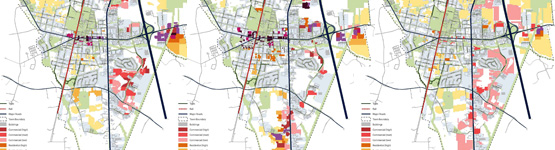
- Gallatin County Growth Scenarios: Gallatin County retained a consultant to use the Spatial Growth Model (SGM) to help develop growth scenarios to the year 2030 representing the views of the development community, ranchers, and environmental interests. Landsat imagery was used as the basic data layer to generate visual representations of the growth scenarios for project meetings.
Examples outside of Montana
- The Federal Highway Administration Transportation & Land Use Planning Toolbox includes several case studies and examples of nationally recognized scenario planning and visioning projects.
Case studies
How can I get started?
Communities interested in developing scenario planning tools and processes can start by gathering information from FHWA's toolbox. The FHWA Montana Planning Division can serve as a helpful on-the-ground resource for local transportation planners. If your community is in or near an MPO region, the MPO staff may be able to coordinate a scenario planning workshop or peer-to-peer networking opportunities for local planners.
Where can I get more information?
- FHWA Land Use and Transportation Planning Toolbox
- Land use-Transportation Scenario Planning: Promise and Reality, Keith Bartholomew, College and Architecture and Planning, University of Utah, Spring Science + Business Media, 2006
- California Scenario Planning FHWA Peer Review Workshops
- Citizen Participation in Scenario Planning for Vermont Long-Range Transportation Plan, Watts, Richard; Poitras, Clay; Chamberlin, Robert, Presentation to Transportation Research Board 87th Annual Conference, 2008.